|
Title |
¿Qué tiempo hace? |
|
Unit/Activity No. |
Human Geography Unit 1/Activity 5 |
|
Geographic Topic |
Climatic patterns |
|
Language Topic |
Weather |
|
Language Function |
Describe |
|
Language Standard |
1.1, 1.3, 3.1 |
|
Geography Standard |
1, 4, 15 |
Teacher Instructions
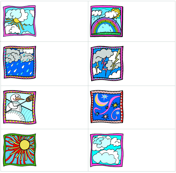
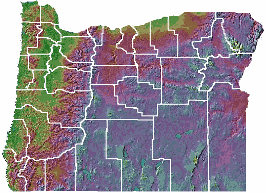
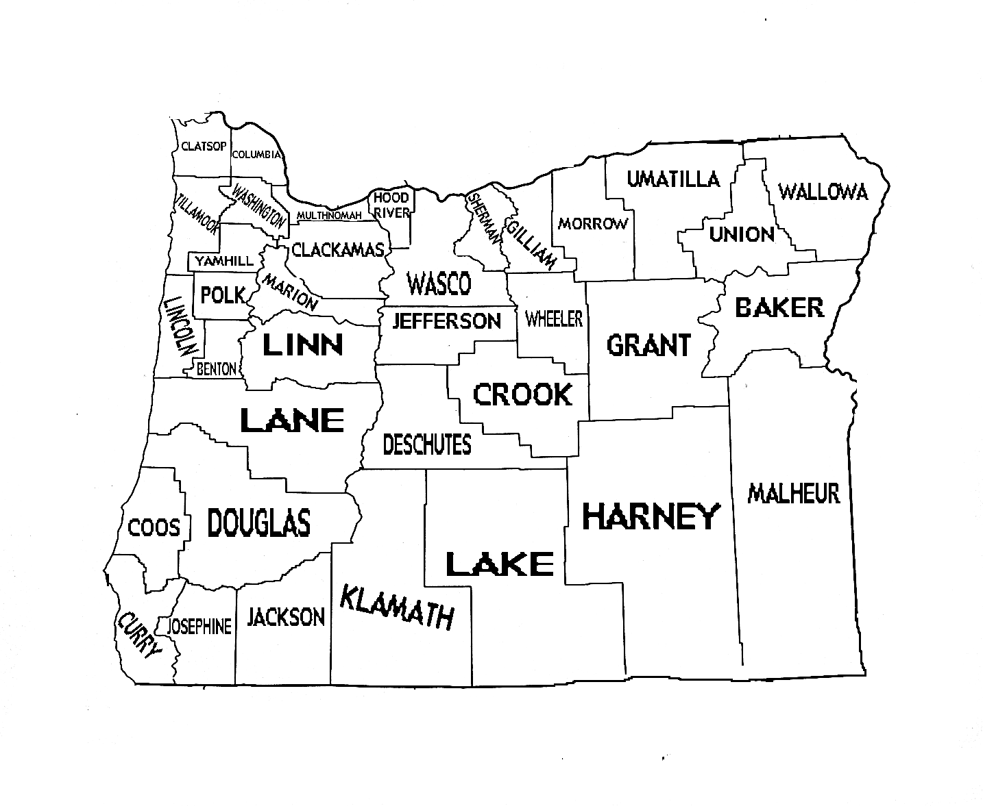
Two maps of the state of Oregon, each with different features labeled (cities, counties, major rivers, etc.), and different weather features indicated with icons.
Erasable ink pens for writing on transparencies.
To generate a variety of maps, start with printouts/photocopies of the outline of the state with physical features. Then overlay clear transparency, writing in different cities on each transparency.
If necessary, review the difference between Farenheit and Celcius systems for telling temperature.
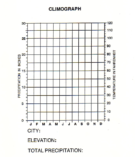
For a model of a climograph, see http://maps.esri.com/climo/help.html, http://maps.esri.com/climo/climograph.html
For detailed instructions of how to produce a climograph using Microsoft Excel, see http://www.geo.appstate.edu/ncga/resources/lessons/climograph_making.html.
Recommended internet sites:
http://CNNenEspañol.com
http://www.mexonline.com/weather.htm
http://www.surf-mexico.com/
|
¿Qué tiempo hace? |
What's the weather? |
|
hace _____ grados, está a _____ grados |
it’s _____ degrees |
|
hace fresco |
it’s cool |
|
hace buen tiempo |
it’s nice weather |
|
hace (mucho) sol |
it’s (very) sunny |
|
hace (mucho) calor |
it’s (very) hot |
|
está (muy) seco |
it’s (very) dry |
|
hace mal tiempo |
it’s bad weather |
|
hace (mucho) frío |
it’s (very) cold |
|
hace (mucho) viento |
it’s (very) windy |
|
hay (mucha) niebla |
it’s (very) foggy |
|
hay hielo |
it's icy |
|
la tormenta |
Storm |
|
hay relámpagos |
it’s lightning |
|
está (muy) despejado |
it’s (very) clear |
|
está (muy) nublado |
it’s very cloudy |
|
hay (mucha) humedad |
it’s (very) muggy, humid, wet |
|
nieva (mucho) |
it’s snowing (hard) |
|
llueve (mucho) |
it’s raining (hard) |
|
está chispeando, está lloviznando |
it’s drizzling |
|
centígrado |
Celsius/centigrade |
|
Fahrenheit |
Fahrenheit |
Handout 1
Paso 1 (Speaking). You and your partner will ask each other what the weather is like in different cities/towns in your state. Use your map to describe the weather in each place, and write in the details that are missing on your own map.
Modelo: Florence
Estudiante A: ¿Qué tiempo hace en Florence?
Estudiante B: Hace mucho viento en Florence hoy. Hace 58 grados.
ESTUDIANTE A:1. Eugene 2. Burns 3. Ontario 4. Salem 5. Newport 6. Pendleton 7. Ashland 8. Enterprise
|
ESTUDIANTE B:1. Klamath Falls 2. Bandon 3. Corvallis 4. John Day 5. Woodburn 6. Astoria 7. Roseburg 8. La Grande
|
Paso 2 (Graphing). Create a climograph (climograma) of two cities, one in Oregon and one in Mexico. Compare the differences between the two and present to the class.
Transparency 1
Transparency 2
Transparency 3
Transparency 4
Temperaturas: México, D.F.
|
|
ene |
feb |
mar |
abr |
may |
jun |
jul |
aug |
sep |
oct |
nov |
dic |
Año |
|
°C |
12.9 |
14.5 |
16.4 |
18.1 |
18.7 |
17.9 |
17.2 |
17.1 |
16.7 |
15.6 |
14.2 |
13.0 |
16.0 |
|
°F |
55.2 |
58.1 |
61.5 |
64.6 |
65.7 |
64.2 |
63.0 |
62.8 |
62.1 |
60.1 |
57.6 |
55.4 |
60.8 |
Precipitación: México, D.F.
|
|
ene |
feb |
mar |
abr |
may |
jun |
jul |
aug |
sep |
oct |
nov |
dic |
Año |
|
mm |
8.1 |
5.2 |
11.4 |
19.4 |
48.7 |
105.8 |
128.5 |
121.0 |
109.6 |
44.3 |
15.3 |
6.5 |
634.3 |
|
in. |
0.3 |
0.2 |
0.4 |
0.8 |
1.9 |
4.2 |
5.1 |
4.8 |
4.3 |
1.7 |
0.6 |
0.3 |
25. |
1. Students can also identify the geographical location of the cities after they describe the weather:
MODELO
Hace fresco en Corvallis porque Corvallis está en el valle Willamette entre Salem y Eugene. Está lejos del desierto.
2. Extension activity: ¿Cómo es el tiempo en México?
Students work in pairs doing an investigation of the weather in México, D.F. Using a map of Mexico and a key with weather icons and a table which shows temperatures in Fahrenheit as well as Celsius (this could actually be made by the students in a short F/C temperature lesson—interdisciplinary with math), they will work together to write on the map to indicate the current (or recent) weather in the Mexican capital.
Materials
Each pair will receive a map of Mexico. (http://www.lib.utexas.edu/maps/mexico.html) They will also get a key with weather icons and a table which shows temperatures in Fahrenheit as well as Celsius. Pens or markers to write on the map. Students will either need printed information about recent weather, or access to the internet.
Assessment Ideas
Students role-play meteorologists, describing current weather conditions in a specific region of Oregon or Mexico. Students work in groups of three, creating a weather report and map. One of the group members is “on location,” and is interviewed by the reporter. Can be expanded to include additional vocabulary, i.e., sports, celebrations happening in the same location, and narrating in the past tense.
Notes
The resulting maps for this activity can be used to compare/contrast with the maps of Oregon that the students used in ¿Qué tiempo hace? above. All of the maps produced can be used in the unit assessments (SP-4101, SP-4103).